Wildfire Carbon Quantification
Main content start
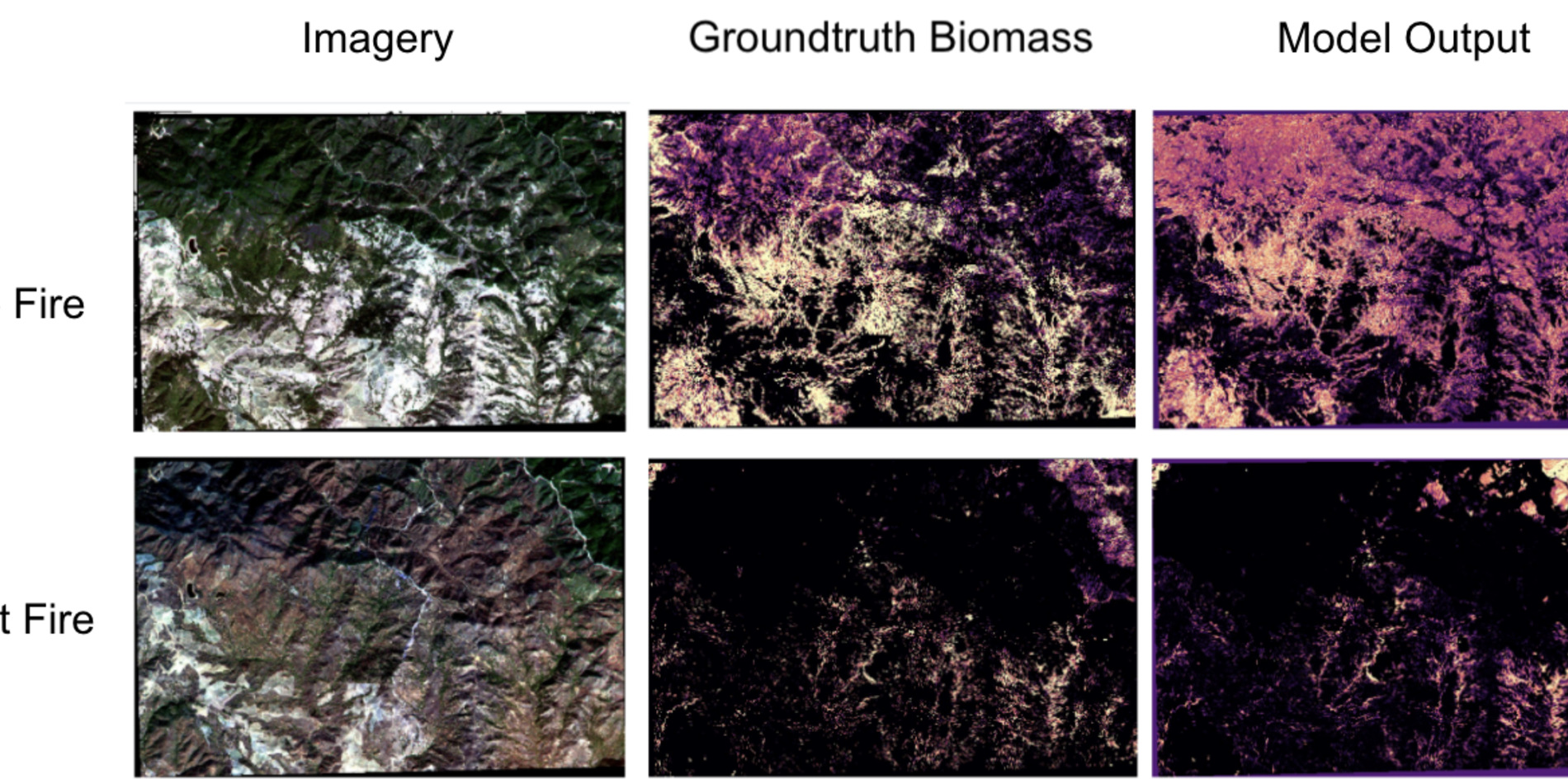
Forest fires pose a double threat to the environment: they strip us of a source of carbon absorption, and they release all the carbon trees have stored over years into the atmosphere. Forest fires are on the rise, and without a formal means of quantifying their impact, we are incapable of expressing the extent to which they contribute to climate change and to ensuring their proper management.
Carbon quantification modeling has been done for decades now, but it often relies on inefficient methods. Kronseder introduced a remote sensing method that used LiDAR to quantify canopy height and regression to estimate carbon storage from canopy height[5]. However, LiDAR data is resource intensive and expensive, as its collection requires the use of planes (rather than satellites).
Researchers therefore looked to Landsat satellite imagery and machine learning in order to predict canopy height at a larger scale, using LiDAR instead as the training data set [3]. The downfall of these studies is that Landsat's coarse resolution does not capture forest texture which is a key insight for the quantity of Carbon stored in the forest.
1. How can we use Planet's medium resolution imagery to improve on past Carbon Quantification metrics and their accuracy/scalability?
2. What type of key indices or outputs can be generated to help organizations and governments accurately value forests?
Forestry Basics
1] Jenkins, J. C., Chojnacky, D. C., Heath, L. S., Birdsey, R. A. (2004). Comprehensive database of diameter-based biomass regressions for North American tree species. Gen. Tech. Rep. NE-319. Newtown Square, PA: U.S. Department of Agriculture, Forest Service, Northeastern Research Station. 45 P. [1 CD-ROM]., 319. https://doi.org/10.2737/NEGTR-319
[2] Sedjo, R. A. (1989). Forests a tool to moderate global warming. Environment, 31(1), 14–20. https://doi.org/10.1080/00139157.1989.9929929
Remote Sensing and Forestry
[3] Asner, G. P. (2009). Tropical forest carbon assessment: integrating satellite and airborne mapping approaches. Environmental Research Letters, 4(3), 034009. https://doi.org/10.1088/1748-9326/4/3/034009
[4] Mascaro, J., Asner, G. P., Knapp, D. E., Kennedy-Bowdoin, T., Martin, R. E., Anderson, C., . . . Chadwick, K. D. (2014). A Tale of Two
“Forests”: Random Forest Machine Learning Aids Tropical Forest
Carbon Mapping. PLOS ONE, 9(1), e85993. https://doi.org/10.1371/journal.pone.
[5] Kronseder, Karin, et al. “Above Ground Biomass Estimation across Forest Types at Different Degradation Levels in Central Kalimantan Using LiDAR Data.” International Journal of Applied Earth Observations and Geoinformation, vol. 18, Aug. 2012, pp. 37–48. EBSCOhost, doi:10.1016/j.jag.2012.01.010.